Friday, April 29, 2011

The month that came in like a lion, and went out like one too.

Well we just about have April in the books now...and boy what a month it was!  April 2011 was above average in every climatological scale you can put it on...and not just above average, WAY above average.  Check out some of these stats I recorded right here in Lawrenceburg:

--12.76" of rainfall for the month, which is an ALL-TIME record for the month of April, and is just barely shy of the wettest month of all-time in Kentucky, period.

--58.2 degrees was the average monthly temperature, which is approximately 3 degrees above average for the month.

--23 out of the 30 days of the month featured wind gusting to at least 30 miles per hour!  Wind records are hard to come by...  but I'm certain this one has to be WELL above average!

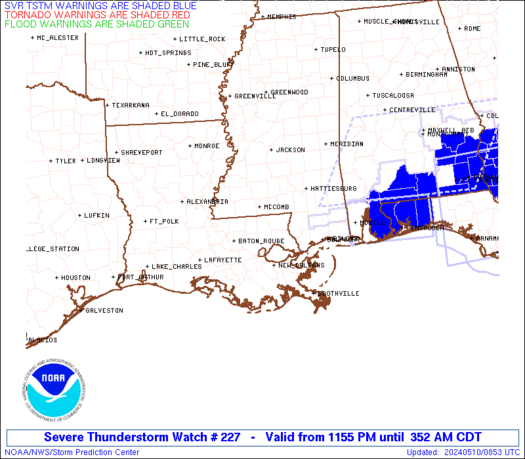
--7 different Tornado Watch or Severe Thunderstorm Watch boxes issued that covered central Kentucky.

--7 different Tornado or Severe Thunderstorm Warnings issued for Anderson County.

To say that it was a wild month would be a major understatement.  We probably won't see a month quite like this again for a LONG time, if even in our lifetimes. 

Statewide there were dozens of tornadoes reported and serious damage from storms from Paducah to Pikeville.  It seems that all of the thunderstorm action has been focused on the southeast this year, rather than the Plains where we usually see it.

Check out this map from the Storm Prediction Center showing all of the damaging weather reports since Januray 1st:


That is just simply amazing.  The entire southeastern U.S., including Kentucky, has just been absolutely HAMMERED all year long.  There has been very little activity relative to average in "tornado alley". 

The bad news is, flooding isn't included on this map and there is a LOT of that going on right now too.  The GFS model isn't providing any relief...it's showing as much as 3 more inches of rainfall moving into the Ohio Valley late this weekend and into next week.  We really need to keep our neighbors along the river in our thoughts...they are going to have a really hard time in coming weeks.

May looks to calm down some over April (how could it not??).  But there will still be an active weather pattern in place.  Cool temperatures and frequent rainfall look to dominate the month. 

Take care and enjoy your Saturday...it's going to be a beauty!

-Shawn

Thursday, April 28, 2011

A fast round of showers tonight...

A quick-hitting batch of rain showers will move through central Kentucky for the rest of the evening and into Friday morning.  This activity may have some lightning with it, and will likely drop pea size hail in places as well.  Having said that, no severe weather is expected tonight.  This activity should quickly move through tonight, and most of your Friday should be gorgeous.  Saturday is looking like a PERFECT Spring day.

Track the rain showers and embedded t-storms here:


The death toll across Alabama, Tennessee, Georgia, and some other states continues to rise.  Prayers go out to their families.  This brings home the point though that you always must pay attention to weather bulletins.  You might not get hit for years and years, but there's coming a day when you will and you should be prepared.  When SPC issues outlooks telling about expected tornado outbreaks, take it seriously.  And when there are Severe Thunderstorm and Tornado Watches posted for your area, it's time to get prepared.  This stuff is serious business.  I really wish the best for those affected and I pray that they can rebuild and do the only thing mankind can do...  thank God for what you have and keep moving forward.

Take care,

Shawn

Wednesday, April 27, 2011

9:00PM update

The threat of severe weather across central Kentucky is diminishing now.  Basically what happened is that the massive tornado outbreak across the deep south prevented an outbreak in Kentucky.  We need to keep those folks down south in our prayers.  They were hit VERY hard tonight.  Last word I got was over 30 fatalities, but I'm sure that number will be on the rise in the next 36 hours.  Just a historic tornado outbreak for much of the nation recently.  This weather is extreme!

But here in Kentucky, things are going to finally start winding down now.  There's still a shot at a thunderstorm here and there through tomorrow, but the severe weather is basically gone now.  Friday and Saturday look gorgeous, and we should have a chance to dry out a little bit before the next system affects the area on Sunday night.

We'll also have a chance to survey the damage left behind, including the landslides and roads/bridges that have been washed away in Kentucky and the tornado and straight line wind damage.  I'm sure details will follow in the local news in the next couple of days.  This was a wild 7 days of weather, and both exciting and tragic, but I for one will be glad to see the sunshine this weekend!

Take care, and thanks for stopping by to check out the site.  I'll work on adding some new information to the page soon.

-Shawn

Tornado Watches in effect Wednesday night

Tornado Watch #239 is now in effect for almost all of Kentucky until 1:00AM Thursday morning.  Here is the area covered by this watch:


Tornado Watch #237 is now in effect for western Kentucky until 11:00PM.  Here is the area covered by this watch:


Dangerous weather conditions are still possible across all of Kentucky until the cold front passes through overnight tonight.  Stay alert..  don't let your guard down just yet!

                                                            Current Regional Radar


 I will continue to monitor conditions throughout the night and will update if watches and warnings are extended into central Kentucky.  Take care and know what you would do if a tornado threatens your area. Now is the time to prepare.

-Shawn

Severe weather update

UPDATE:  (12:45) SPC just released a new outlook moving the Moderate Risk area farther west to include more of central KY.  They are anticipating that tornadic thunderstorms will initiate roughly along the I-65 corridor in Kentucky this afternoon and race eastward, affecting more of central Kentucky than previously thought.  This includes the possibility of violent and/or long-track tornadoes in the Lexington vicinity.  This is a dangerous situation...  stay tuned to local media and weather radio for watches and warnings this afternoon.

-Shawn


Current Watches/Warnings


Valid WW Image


As of noon today, the storms that brought Tornado Warnings to central KY have pushed off to the east and everything is calm for now.  Clearing skies has allowed sunshine to peek through and most of the afternoon will be beautiful!

Here is the latest SPC outlook for the rest of today:


You can see that eastern Kentucky is under Moderate Risk, while central and western KY remain in Slight Risk.  I think that based upon current satellite imagery, radar imagery, and the new 12Z computer model data that I've seen...  the most severe of the weather this evening will roll through Tennessee and eastern KY.  That doesn't mean that Lawrenceburg/Frankfort/Lexington are totally in the clear...  just that the WORST weather will probably miss us just to the east and south today. 

This is because of what I meantioned last night...  the area of rain and cloudiness this morning has prevented full destabilization of the airmass over central KY.  If we hadn't had that rain this morning...we could be looking at a deadly situation here today.  But as it is...  we may be spared from the worst.

Remain on guard today though...  stay alert to NOAA weather radio for watches and warnings as they come out.  If you have family living south and east of here, call them and tell them to be ready in case tornadoes threaten their area.

Here is the latest statement from the National Weather Service office in Louisville:

FOR NOW...WHILE GREATEST INTENSITY AND COVERAGE OF SEVERE WEATHER
INCLUDING TORNADIC SUPERCELLS WILL BE TO THE SOUTH OF KY (AS PER
SPC
OUTLOOK)...CENTRAL KY COULD WELL SEE ANOTHER ROUND OF SVR WEATHER
FROM MID AFTERNOON THROUGH THIS EVENING...WITH ALL SEVERE WEATHER
MODES POSSIBLE.

Will continue to monitor the situation through the afternoon.... 


-Shawn

The Grand Finale

Latest statement from NWS Louisville:

LOOKING AT CLEARING RAPIDLY MOVING IN FROM THE WEST AND CONVECTION FIRING OVER
SOUTHERN AR WITH SECONDARY LOW PRESSURE...FEEL THE CHANCES ARE
INCREASING THAT MODERATE RISK WILL BE MOVED WEST AND WE WILL SEE
SEVERE STORMS FIRE UP AGAIN THIS AFTERNOON AND EVENING. WILL
CONTINUE TO MONITOR THE LATEST TRENDS. PUBLIC SHOULD CONTINUE TO BE
READY FOR A SIGNIFICANT SEVERE WEATHER EPISODE ACROSS THE ENTIRE CWA
LATER THIS AFTERNOON AND EVENING.


This system still has the potential to cause widespread damage across all of central Kentucky this afternoon and evening.  When the new 12Z model data comes in, I'll look over it and see what's going down.

For the meantime, Tornado Watch continues in effect for much of the Lawrenceburg/Frankfort/Lexington areas until 11:00 this morning.  Stay alert for possible warnings later...

-Shawn

Tuesday, April 26, 2011

Tornado Watch #219 update

Tornado Watch #219 continues in effect for much of central KY including Frankfort, Lawrenceburg, and Campbellsville through 23:00 (11PM) tonight.  There are not many storms out there at the moment, except for the supercell that caused damage in Grayson and Hardin Counties.  This storm is weakening and the warnings have not been continued on it.  SPC has indicated that later tonight, another Tornado Watch may possibly be issued for parts of central Kentucky due to convection that has blown up across western Kentucky again and is moving generally this direction.  Madisonville, KY is about to get HAMMERED as of 22:00 EDT.

In the Lawrenceburg area, I wouldn't lose sleep over it.  I would just make sure to keep the weather radio on alert mode nearby so that if warnings are issued you can be alerted to them....but for now it appears that things should remain relatively quiet for at least a few more hours.  Storms will likely be widely scattered for a while tonight before business picks up again tomorrow.

Massive severe weather outbreak likely Wednesday

We have certainly seen our fair share of wild weather in the past week across central KY.  Not only have we broken the record for the wettest April EVER recorded, but we are fast approaching the record for the wettest single month of all time!  This is just astonishing.  But the crazy weather doesn't stop there...

We have also seen a lot of severe weather.  Dozens of tornadoes have been reported in Kentucky alone, let alone the rest of the southeast which has seen devastation.  Just last week, my grandmother's neighborhood in Versailles was struck by a tornado from the same storm that had sirens sounding for 90 minutes in Lawrenceburg. 

All this severe weather was expected (see my blog entry from a month ago at http://www.theandersonnews.com/content/very-active-severe-storm-season-could-be-shaping) but it doesn't make it any easier to deal with.  We've seen lots of structure damage, trees blown down, dams are failing, roads are sliding in, and towns are evacuating because of flood waters.

It appears that this stalled out frontal system we've been dealing with for a week will finally get pushed off to the east on Thursday.  But it's going to go out with a bang on Wednesday before it does.  Computer model forecasts show our area going very unstable tomorrow, as can be seen on the latest Lifted Index chart.


The light blue shading over much of Kentucky is indicative of Lifted Index -5 to -7, which is starting to get extreme.  At this same time that this is happening, we find ourselves under the favorable exit region of a 200mb jet streak.


Both of these charts are valid Wednesday evening.  The cold front will be passing through this extremely unstable and dynamic airmass and generate a lot of helicity, or spin, in the atmosphere.  Combine all of this with tons of moisture...and you've got the recipe for a massive severe storm outbreak including tornadoes.  The one fly in the ointment is that we may have rain ongoing tomorrow morning...and if so, this could limit some of the instability.  But...if we do not have rainfall here tomorrow morning, and if the sun shines bright for a while tomorrow, LOOK OUT.  This atmosphere will explode.

The Storm Prediction Center currently has all of central Kentucky outlined in a Moderate Risk of severe weather tomorrow.  An upgrade to the highest possible level, High Risk, is a possibility soon.  I strongly recommend that everybody keeps an eye on the sky tomorrow.  Keep a NOAA weather radio on alert mode near you so that you can receive watch and warning messages quickly, and have a plan of action ready.  Know where you will go if a tornado threatens your location.  Now is the time to prepare. 

More updates will follow on this very serious storm system tomorrow morning...check back often.

-Shawn

Tornado Watch #219

Tornado Watch #219 is in effect for the I-65 corridor of western Kentucky from Louisville to the TN state line.  Dangerous thunderstorms may move into this area later this evening.  Be prepared to take shelter if a tornado WARNING is issued for your area later!

Under construction

This site is under construction and should be up soon.  It will focus on severe weather for central KY specifically and will keep you updated on dangerous weather conditions right here at home.