Wednesday, December 21, 2011

Christmas update

The Euro model, which was pretty solid going into early this week, has now abandoned the idea of a big storm rolling through Kentucky this weekend.  So now, there are officially no models supporting the idea of a white Christmas for the Bluegrass.  The only frozen precip. we may see will come in the form of a few flurries on Friday night as shown on the latest run of the GFS model:


It wants to kick up a little precipitation diurnally during the evening Friday, and then that dies off after sunset.  But even at that we're looking at a high around 42 degrees so snow flakes will be very hard to come by.

Sigh..  it's tough.  We looked to have a good shot at putting something down this year, but our hopes are fading fast as now the models are all keeping this weekend mostly dry.  Oh well, at least travel will be safer this way, and we have 3 to 4 MONTHS of winter ahead of us.

By the way, as of 12:30 in the morning, just a few hours from now, we are at the winter solstice.  That means that the sun is directly over the Tropic of Capricorn (23.5 degrees south latitude) and tomorrow will be the shortest day of the entire year, in terms of daylight.  Each day from now until June will get longer and longer!  Yay!

Merry Christmas and a Happy 2012.


-Shawn

Tuesday, December 20, 2011

Tuesday Christmas weather update

Good morning.  A very quick update on how things are playing out for the Christmas weekend coming up..

The weather modeling is basically in two camps this morning.  Some show energy moving through west to east early in the Christmas weekend, which could at least put flurries or light snow into the air for Christmas Eve, and then Christmas Day stays dry.  The GFS and MRF models are in this camp.  The other camp says that we get multiple waves of energy moving up from the gulf toward the east coast or appalachian mountains throughout the weekend.  This would give us chances for on and off rain, but it would keep our temperatures slightly too warm for snow.  The Canadian (CMC) and European (ECMWF) models are in this camp.

Just for fun, here is the latest MRF chart valid Christmas Eve:


The solid black line is the freezing line about 5,000 ft. up above us.  Kentucky is firmly in this zone.  At the same time, precip. is backfeeding from a strong low moving through the Carolinas.  This model shows snow in the air on Christmas Eve for Kentucky.  It is currently the only model run that is this bullish on a scenario like this playing out.

The point is, we are now only 4 days out, and every computer model is showing something completely different.  Winter is ALWAYS a very tough season to forecast weather in..  but this year in particular has been horrible lately.  This is the worst I've ever seen the models perform.  You simply cannot say for certain what the weekend will bring.  At this point, dry conditions, rain, and snow are all possibilities.  It's a weather guy's worst nightmare.

I will update again tonight on what I personally think is going to actually happen this weekend.  I'm going to look over the model runs this afternoon, and then tonight I'll take a stab at what we will honestly see play out. 


-Shawn

Sunday, December 18, 2011

White Christmas for Kentucky?

Good Sunday afternoon.  I thought I'd post up a quick update on the weather for next weekend.  Today's run of my favorite weather model, the good old American GFS, is sticking to it's guns on developing a storm on the gulf coast this weekend, and then shooting that storm up the east coast the day after Christmas.  This most recent run actually brings a cold rain to us on Christmas Eve, then dries us out briefly before bringing in a mega-storm late Christmas night.  Check out the chart valid 11:00PM Christmas night:


You can see the low as it is strengthening near Atlanta, GA Christmas night.  The next several hours of this model run shows this low getting stronger as it moves toward Virginia.  On this chart you can see that the freezing air is already moving into Kentucky as the precip. is increasing from our south.  That's a textbook recipe for SNOW for us. 

Taken literally, today's GFS charts would mean a big time snowstorm for Kentucky counties that are east of I-75.  Travel on I-75 Christmas night into Monday morning would be severely impacted due to the harsh weather and the lack of manpower out clearing roadways (it IS the holidays afterall). 

Folks west of I-75 would see snow too, but it would not be a massive snowstorm for us.  It is important to remember that we are still a full WEEK away from this storm, and details on it will change as we get closer.  This is obviously not set in stone.  But the point is, the chance for a white Christmas for some of us is still on the table.  If you plan on traveling in eastern Kentucky next weekend, you'll want to keep a close eye on this one.

It's all a matter of the track of the low and the strength of the low.  We need a STRONG low to pull the cold air in rapidly from the northwest, and we need it to track toward western Virginia.  If we can get those two things to come together next weekend, we'll be looking at everything WHITE.  Stay tuned...

-Shawn

Tuesday, November 29, 2011

Kentucky Winter Outlook - updated thoughts

We're staring December in the face now, and the word "snow" has been floating around amongst people this week, so let's talk about what is probably coming down the road for us.  For starters, the Christmas parade this Saturday looks to be in excellent condition.  Dry weather should be the rule, and it will certainly feel like Winter with temps. below freezing at sunrise and into the 40 degree range by noon.  Bundle up warm and go enjoy the parade.

Sunday looks to be wet again, as yet another slow moving weather system inches it's way into the Ohio Valley.  We've already had flooding issues in Anderson County this week, as well as other parts of the state.  The Kentucky river is also approaching it's minor flood stage and will cause some problems by Thursday for a lot of folks.  We do not need any more rain.  At the Lexington reporting station, we are a little over 4.10" away from making 2011 the wettest year EVER recorded.  With over a month to go, the odds of smashing that record are pretty good.  Despite the fact that we don't need any more rain, we are going to get some, and it starts on Sunday.

Beyond Sunday, I think we'll dry out for a while and just stay cold.  I see another pretty big storm system toward the middle of the month, and it could be another big rain producer for us.  Even though temperatures are on the way down, none of the weather systems showing up in the near future appear to be snow storms.  I think most everything will fall as rain, at least through the first couple of weeks of December.

The La Nina pattern that I discussed in my last blog post is still in full effect and will probably continue to control our weather for the Winter.  I do think, though, that it will break down slightly as we head into December.  Check out this upper level jet stream chart valid toward the middle of the month:


You can see on this chart that a big trough will be swinging through the Ohio Valley.  This actually looks to be a little more common going into December.  More of the "dips" in those lines on the map can show where the cold air will be moving, and in this case it's moving directly into our region.  These troughs will swing through every few days and bring shots of cold air with them.  December looks to be quite a bit colder than what we've seen in the past 8 weeks...but it does not look to be as cold as last December which was brutal to say the least.  Again, the timing of these cold shots doesn't look to be favorable for any big snow storms.

I think that as we head toward Christmas and the new year, we'll see full blown Winter move in for 2012.  I expect January to be a harsh month here, and I think that if we get a "big one" it'll happen in January.  Keep your eye out for possible ice storms during this time as well. 

February should bring a relief from the harsh weather with a slight warming trend and some rainy weather and then where we go from there is really hard to say, but I do think that the March to May 2012 period will feature some crazy weather including more severe weather and tornado outbreaks, similar to 2011.

For all you snow lovers out there, check out this snow cover map of Canada:


It's not even December yet, and almost all of Canada is already covered in snowpack!  This could be a good sign for us going into late December and January, because the snowpack keeps the cold air primed and ready to make a run at the Ohio Valley whenever it gets a chance to.  This cold and snow to our north can and lots of times does translate southward, so keep your fingers crossed.

Some of the other Winter weather indices we look at are also looking favorable for a wild period of weather, so it should get really interesting here in the next 6 weeks.  But, as always no one can say for certain what's going to happen.  We're all just along for the ride.  Get those coats ready though, because one thing is for sure... it's about to change from what we've been seeing.

-Shawn

Wednesday, November 9, 2011

A brief November update

I've been talking about La Nina a lot.  Well, right on cue a textbook La Nina weather pattern has set up and looks like it will lock in going through November.  Here is the 250mb chart showing the upper jet flow on Monday of next week:


What you notice right off the bat is the disturbance in the southwestern U.S.  This storm would then ride northeast toward the Great Lakes on that fast flowing jet streak moving directly toward Chicago out of the desert southwest.  This setup is a perfect example of what we see typically in La Nina years.  The really bitter cold Winter air is bottled up in the northern tier, while the southeast is seeing warm conditions because they are south of that jet.  The Ohio Valley lies right in the war zone.  This pattern is why we see a storm system roll through every week, but it is also why we won't see snow anytime soon because it's keeping the cold air held north of us. 

That ripple, or dip in the jet that you see moving into western Texas on this chart will eventually move through the Ohio Valley... this will drop our temps after the front passes and give us some rain.  Then a couple days later the chart will look just like this again and Kentucky will be basking in 60s.  It's a broken record, and it looks to me like it will be the rule in November.

I would strongly caution people to keep in mind that this is exactly what we dealt with last year.  October was gorgeous.  November was a rollercoaster of ups and downs.  Then in December the bottom fell out and it was full-blown Winter here.  I'm not saying that it's going to happen again this December..  but it's a distinct possibility that when the dam breaks and that cold air bottled up in Canada does finally drop in, it might come in with a vengeance.

For now, enjoy these nice Fall days we are seeing in November.  It is, afterall, the month of Thanksgiving for all God has created and all He has blessed us with.


-Shawn

Thursday, October 6, 2011

Winter 2011-2012 Outlook

Here are some early thoughts about what Winter 2011-2012 may bring to central Kentucky.  Please remember that it's still early Fall...and we've got a long way to go before we are truly into Winter.  The holiday season is almost upon us though (Halloween, Turkey Day, CHRISTmas, and the New Year) so let's at least explore the possibilities for what could be coming up.

Let me start off by showing you what the official government outlook is currently predicting for Winter, courtesy of the fine folks at the Climate Prediction Center.  You'll see that the temperatures are forecast to be normal for us.  So whatever the typical temperatures are for the given month we are in...that's what they are forecasting that we will see.  Precipitation however is forecast to be considerably above normal.  In fact, they have drawn a bullseye of precipitation right on top of Kentucky in their maps.  Take a look and then we'll talk about why the maps look like they do.


One of the contributing factors to our weather last Winter was La Nina.  This typically causes the jet stream to hang out in the midwest section of the nation, and that in turn steers a lot of storm systems into the Ohio Valley.  That's one reason we had lots of frequent snows last year.  La Nina is predicted to redevelop this Winter, and the last charts I saw indicated that it could become a fairly strong La Nina pattern.  So most climatologists myself included believe that the jet stream will once again spend a lot of time dividing the nation through it's heart, rather than staying south of us like we typically see.  For this reason, temperatures are expected to stay seasonable through the Ozarks and into the Ohio Valley.  "Seasonable" for Kentucky still means cold...just not abnormally cold for extended periods of time.

With precipitation the position of the jet comes into play once again.  Just as last year brought frequent weather systems, this year is expected to be similar.  With the average position of the jet expected to be in the nation's mid section, a lot of moisture should be able to pool into the Ohio Valley on southerly winds.  As weather systems fly in on the atmospheric flow from the west and run into this feature, precipitation should be common here in Kentucky.  One fear is that with the war zone between warm southerly air to our south and cold polar air to our north being parked over the Ohio Valley with this jet stream, we could end up in the zone of "wintry mix" type weather.  Therefore, this Winter will have an increased risk of ice storms here.

The overall weather experienced for us in a nutshell should be normal in terms of temperatures, but perhaps not quite as many cloudy depressing days as we usually see thanks to the jet keeping systems moving through in the flow.  But with that will also come some heavy rains, and possibly heavy snows or ice storms from time to time.  I don't think it'll be a boring Winter by any means.  Cold snaps to go along with warm spells, and sunshine to go along with clouds, snow, and rain.  I'll take that deal, as I really hate the Winters that keep us cloudy all the time.

Just to jog your memory, last year October was nice in terms of temps and rainfall.  Very similar to what we are seeing this month.  By November, we were seeing wild swings in the weather.  And by December the bottom fell completely out.  We finished December 2010 with a monthly average of 26 degrees in Lawrenceburg, which is well below where we should have been and set records.  So it can go downhill quickly.  Don't let this month's nice weather fool you.

Now, here is the fly in the ointment.  Since February, every single month in 2011 has been wet in Lawrenceburg with above normal rainfall.  I am a firm believer that nature always keeps a balance, and some drier than normal months are coming ahead.  There is no question about that.  The question is when?  Will these dry months show up this Winter or will we see a continuation of this active pattern until late Spring or Summer turns into a drought?  I suppose time will tell.  I think that regardless, the coming Winter is going to be a fun one.

By Thanksgiving, I will update this outlook with the latest model data and we'll try to nail down what Winter will hold for us this season.  Have a good one...

-Shawn


Thursday, August 25, 2011

Hurricane Irene and thoughts on Labor Day weekend

Here is a good video from the guys and gals over at Accuweather.com showing the latest on Irene:

Irene update - Thursday night

My thoughts on Irene...  

This is a very dangerous storm.  I am still maintaining my thoughts that Irene will hit Cat. 4 status on Friday as she moves into completely open waters off the coast of Georgia that are in excess of 90 degrees.  Water this warm will not only sustain Irene, but allow her to strengthen.  Currently, she's a Cat. 3 storm and has been maintaining this strength for quite some time now.  There won't be any problem for her to move up another level on the Saffir-Simpson scale tomorrow.

Then on Saturday the fun and games begin.  Because Irene is moving due north, she will run parallel to the coast.  The problem with this is that we'll see a lot of water flowing in directions that coastal residents are not used to.  This storm, because of it's trajectory, is going to create an enormous flooding problem for millions of people.  The wind will be destructive, sure.  But the water is going to be the biggest problem.  We've seen other hurricanes before move into New England and cause mass destruction, but they were not as powerful as Irene is capable of being.  If the current model data on this storm comes true, you're going to see the biggest natural disaster in the mid-Atlantic coast and New England than we've seen in our lifetimes.  I urge anyone on the east coast to take evacuation orders seriously and please leave.  If you have family on the coast or near the coast, please try to convince them to leave.  You don't want to be anywhere near the east coast this weekend, and you don't want to wait until Friday night to try and leave either because the interstates will be jammed.

The ocean waters cool off drastically as you head north toward New York City, so it is likely that Irene will lose power quickly on Sunday, but the damage will still be done.  Right now all we can do is pray that the model data is incorrect and some wild, unexpected change in track occurs with this storm.

In Kentucky, the hurricane is going to bring northerly winds to us this weekend.  We'll be in that area of subsidence, or sinking air, on the western flank of the system.  This will result in dry, cool, and less humid conditions for us all weekend.  Enjoy it!

As we head into next weekend, the Labor Day holiday looks to come in HOT.  The medium range modeling is showing a strong ridge building back into the eastern U.S., similar to what we saw during July.  This should result in temperatures heading back into the 90s and the first week or two of September should be a hot one around here.

This latest run of the GFS model shows that an active area of thunderstorms could be knocking on the door by Monday (the actual holiday):


You can see that we are firmly entrenched in the 30+ degree temps (Celcius) here in the Southeast, which translates to 90-95 degree heat wherever there are not t-storms.  But that front moving into the MS River valley looks to have a punch, so we might see some nasty weather to knock the temps. back down for a couple of days immediately after Labor Day.

The Summer Outlook has worked out great.  We've seen heat.  We've seen days in the 70s.  We've seen occasional rain to keep the drought away.  And now we're seeing Jim Cantore on TWC about to pee himself from excitement over the tropics coming to life.  I couldn't be happier with that forecast.

Just a teaser..  but Winter could shape up to be epic this year.  Stay tuned.  ;o)

-Shawn

Wednesday, August 3, 2011

Severe Thunderstorm Watch

More severe weather is moving into KY following the round of damage we had this morning.  A Severe Thunderstorm Watch is posted until midnight.  Here is a look at the counties in the Watch box:


After this round of storms passes tonight, much drier air should filter in and tomorrow looks to be a gorgeous day.

The blog has been taking a break in this boring Summer pattern..  but will be up cranking again as we head into Fall.  So far, things are working out pretty well for my Summer Outlook.

-Shawn

Monday, July 11, 2011

Can it get hotter than this?

Here is the SPC outlook for tomorrow.  Almost all of Kentucky is in the Slight Risk zone for severe thunderstorms.  Hopefully, we will indeed see storms because they will temper the heat a little.  But keep in mind that any storms that do develop will be able to go severe and cause damage.


Check out this pic from right here in Lawrenceburg this afternoon.  Wow.  If you remember, 11 months ago we were seeing heat index readings in the 120s!  I don't recall ever seeing heat index readings that high in Kentucky before.  Well, today we are approaching those numbers.  This is DANGEROUS heat.  Please take this seriously.  People die in the heat every year unexpectedly.

The NWS has a Heat Advisory in effect Tuesday for the bluegrass counties.  Everybody along and west of I65 is under an Excessive Heat WARNING.

Take care out there.

-Shawn

Friday, July 1, 2011

Summer 2011 Outlook

At the end of March, I wrote an outlook for Spring that predicted a very active severe weather season in this part of the country.  Unfortunately for many, this prediction was spot-on.  In fact, even more so than I expected.  From Minneapolis, to Joplin, to Birmingham...severe weather ripped the nation apart.  Right here in Kentucky we recorded dozens of tornadoes and set new records for rainfall and flooding.  The tornado in Joplin, MO set a new record for most lives taken by a single tornado in U.S. history.  Just two weeks ago we saw Kentucky’s two largest cities, Louisville and Lexington, both go under tornado warnings within a 24 hour period.  Spring was a wild season and we probably won’t see anything quite like it in many years to come.

I’m running about a month late, because hurricane season technically began on June 1st, and astronomical Summer began on June 21st, but I’m going to give this a whirl anyway seeing as how we are just now getting into the real pattern of Summer.  The question is, after the kind of Spring we just had where does Summer go from here?

I think that Summer in Kentucky this year will be slightly different than what we’ve seen in recent years.  For the same reasons that Spring was so wild, Summer will likely stay a little wetter and a little cooler on average than what we’re used to lately.  During a La Nina cycle, the jet stream generally moves northward.  Rather than hanging out along the Gulf coast, it will tend to spend a lot of time flowing across the Midwest and into the Great Lakes.  This alters the storm track and pulls moisture northward into the Ohio Valley and also steers the storm systems our way.  This resulted in a terribly active severe weather season in our part of the world.  We are now seeing the La Nina (cooling waters of the Pacific equatorial region) start to weaken a little and we’re going back toward neutral.  But coming off a La Nina cycle I still think that the overall storm track may continue to bring occasional rainfall to Kentucky through the Summer.  This is not to say that we won’t have dry periods or hot days.  I do think though that the average temperatures will stay in check, and we won’t see a severe drought this Summer.  Remember 2007?  That was a horribly dry and hot Summer with almost zero rainfall for several months.  Summer 2010 wasn’t very fun either.  We saw many days in August last year with heat index readings in the 120s.  I’ve never seen heat index readings that high in Kentucky before in my life.  I do not think we will see a repeat of this in 2011.  I think that overall, Summer 2011 will be a very average Summer statistically and the really intense heat and drought will stay away.

Another consideration is the hurricane season.  Coming off a La Nina cycle, it is very possible that the upper level high that we saw in place last year will not establish itself as persistently this year.  Last year we saw no hurricanes strike the U.S. coastline.  Most storms that tried to invade the Caribbean and threaten the U.S. coast were sheared apart by the intense high pressure aloft that hung out in the Caribbean all Summer and Fall.  With the general location of the jet stream retreated slightly northward, and the historical removal of this upper level high in the Gulf region that we see with La Nina, I think it’s very possible that this year we could have more hurricanes.  Not only this, but those hurricanes will be able to penetrate into the Gulf region and grow stronger as they move into a position where they could threaten the U.S. coast.  I doubt that it’ll be a 2005 type season all over again, but it should shape up to be more active than average in the Atlantic.  How does this relate to Kentucky?  Well, much of the rainfall we receive in September and October comes from the remnants of tropical systems.  The same storms that devastate the Gulf coast are the ones that provide relief and rainfall to the southeastern states during what is typically the driest season of the year.  If we do indeed see a more active hurricane season this year, that could also translate into additional rainfall for Kentucky as some of these systems will pass their remnants over or near the Commonwealth.

So there you have it...if everything comes together as expected I think Summer will be less extreme and more normal for what we should see this time of year.  There will be days in the 70s to go along with those days in the 90s.  There’ll be rain here and there to keep the ground from drying out too bad.  And we’ll see a lot of Jim Cantore on The Weather Channel.  I hope this forecast works out well, for the farmers’ sake.

Just for kicks, I looked up the official Summer outlook put together by the Climate Prediction Center.  They are expecting "climatology" to be the rule... which basically means that Summer will be very average in their opinion.  Neither drier than normal nor wetter than normal, neither hotter nor cooler than normal.  Just a very typical KY Summer.  Not too far from what I'm expecting.  Here are their charts:

Temperature:


Precipitation:


-Shawn

Monday, June 27, 2011

Severe Thunderstorm Watch...

Good afternoon.  A Severe Thunderstorm Watch has been issued for much of the Bluegrass of Kentucky valid until 21:00 tonight.  I suspect that this won't be the only watch box issued as we head into the afternoon and evening hours. 

Here is a look at the current watch, as well as current warnings:


The high resolution models point toward convection blowing up rapidly across east-central Kentucky this afternoon....basically in and around the Lexington area.  This will occur as a warm front lifts northeastward through the area today, and runs into a very unstable atmosphere.  SPC has increased the tornado threat for us as well. This morning they indicated a 2% chance of a twister here...  now we are in the 5% range.


We will need to keep a sharp eye on the weather this afternoon!   Tonight and especially tomorrow morning, the cold front of this system will approach and this may trigger more severe weather, particularly if the front slows down which would allow it to come through during the afternoon hours. 

Just make sure to keep your NOAA weather radio on at all times so you can recieve the latest warnings as they come out.  If you have outdoor plans today, I'd definitely recommend having a plan in case a severe storm approaches your location.

-Shawn

Tuesday, June 21, 2011

More storms

Here's the latest weather map:


You can click on it for a larger view.

The warm front has passed to our north now, but the cold front is still to our west.  This puts us in the zone called the "warm sector" of the system...where warm southerly winds carry heat and moisture into our area.  This, combined with ample sunshine out there this morning and a good upper level jet flow is creating a very ripe atmosphere for thunderstorms to blow up.  In fact, storms are already going now across middle Tennessee and are moving northeast into southern Kentucky this morning.

As the day wears on, I expect thunderstorms to continue to blow up along the I 65 corridor of Kentucky and intensify into possible supercells and small line segments.  These storms will drift northeastward into the Bluegrass counties of Kentucky later this afternoon.  VERY heavy rainfall, flash flooding, and high winds with downbursts will be the threats from these storms.  Intense lightning will be a good bet too I think because of all the water vapor in our airmass.

Stay alert today, especially if you're going to be outside as these storms could blow in very quickly.  Tomorrow, the cold front on the above map will blow into Kentucky, and more severe weather will be possible along the front.

-Shawn

Friday, June 17, 2011

Storms moving in...


Storms will move into the I 65 corridor of Kentucky this evening.  Isolated wind damage and hail will be possible.  Farther east... the Lexington area looks to stay dry for at least a few hours.  We MIGHT see a little storm activity here this evening but most of this stuff will slide just to our south.  In any case...any rain we get will be welcomed!

Tomorrow..  this entire area will see a good shot at thunderstorms, and some could be severe with damage.  Stay alert if you plan to be outdoors tomorrow..  especially if you plan to be at the lake or on the river somewhere.

-Shawn

Tuesday, June 14, 2011

Finally... some rain.

Back in the Spring, I never thought I'd be saying this... but we need rain.  The first 14 days of June have proven to be bone dry here in Lawrenceburg, as well as most areas in the Bluegrass.  In fact, it's been 19 days since we had any measurable precipitation at all here.  The yards are turning brown and are getting a McNugget-like crispyness to them.  After record setting rains in April and into May, we are now praying for some moisture from the sky.

It looks like that might finally happen on Wednesday.  An area of low pressure will organize just west of us and move northeastward just  north of the Ohio River tomorrow.  This should be a good enough spark to finally break the sky open and create rain here in central Kentucky.  In fact, some strong storms could be possible.  That's something we'll have to keep an eye on as the Storm Prediction Center has the entire state of Kentucky in the Slight Risk zone for severe weather as of right now.

I'm going to try and post up a nice radar image to follow the rains here:


Looking ahead to the weekend, it appears that we might actually see another good shot of rainfall from Friday into the first part of next week as a frontal system may stall out in the Ohio Valley.  This would allow multiple complexes of thunderstorms to ride along the front and attack the central Kentucky area from the northwest.  One thing I've learned in my years studying weather in Kentucky is that you always have to be cautious forecasting rain in the Summer.  The models seem to pick out what should be a good rain-making system and then that type of setup never materializes and the forecast for rain becomes a bust.  So I'm sort of a "gotta' see it to believe it" kind of guy when it comes to heavy rainfall in the Summer.  But...  I'll just throw it out there that the GFS model in particular is showing a LOT of rain over the course of the upcoming weekend.  With training systems repeatedly moving in, it could possibly turn into a nasty weekend.  But.. we'll wait and fine tune that forecast later.  And if it does rain, we do need it so no complaints here.

This is what the GFS model is currently showing for Saturday afternoon:


You can see that it's wanting to stretch rainy weather from Minnesota all the way to South Carolina as storms ride along that front.

It's been a crazy year weatherwise.  From record cold and snow, to record rainfall, to tieing all-time record high temperatures in June with zero rainfall... we've seen it all this year.  I'll start looking into the July-September forecast soon.  That is always the part of the year when it gets hot, humid, and dry here...so it'll be interesting to see where we go from here in 2011.  Will this wild pattern continue?

Keep the NOAA weather radios ON and set to alert mode tomorrow.  (Really, they should be 24/7).  If you don't have one, pick one up at Kroger for $29 bucks... or if you can afford to spend a little more..the Midland WR-300 is awesome and is just a little bit more.

-Shawn

Tuesday, May 24, 2011

Yet another massive outbreak coming up.

UPDATE (12:00):  SPC has issued a statement indicating that they will expand the High Risk area eastward this afternoon to include more of Kentucky, including Louisville and Bowling Green.  We'll have to wait until they issue the outlook to see exactly where the outbreak is looking to set up, but the bottom line is that the weather situation is growing increasingly more threatening with each passing hour.

Upper level winds are not very high with this system, but it looks to me like helicity and shear values ARE high, as well as moisture and instability.  So the ingredients are together for supercell type storms to develop, and those are the kind that can produce violent and long-lived tornadoes.  This activity will affect western KY later this afternoon and may approach the I65 corridor by later tonight.

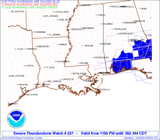
Please urge your family and friends to keep the weather radios on alert mode and stay tuned to the NWS website (www.weather.gov/louisville) if you are in an area away from weather radio access.


Just added:  Here is a new look at the current outlook from SPC:


-Shawn


UPDATE:

SPC has upgraded western Kentucky to HIGH RISK for severe weather today.  A deadly outbreak of tornadoes and wind damage is LIKELY just to our west.  Central Kentucky is upgraded to Moderate Risk.  Latest model data coming in reveals that much of Kentucky, southern Illinois, southern Indiana, and Tennessee could see destructive storms today and tonight.  Here is the latest outlook:


Please take this seriously.  Keep your NOAA weather radio on alert mode today and if you have any family or friends in the High Risk area, warn them to stay constantly alert to weather conditions.  We do NOT need any more fatalities!  We've had way too many this year already.  More updates later...


-Shawn


The eastern half of the U.S. has been absolutely hammered by severe weather this season.  This was predicted nearly two months ago (see this link: http://www.theandersonnews.com/content/very-active-severe-storm-season-could-be-shaping ) and unfortunately the prediction has been spot-on.  We've also seen large cities such as Birmingham, Tuscaloosa, Minneapolis, and Joplin sustain massive damage and fatalities which is unusual.  The severe weather train is still rolling and will flare up again on Wednesday and Thursday.

Here is the current convective outlook for Wednesday from the Storm Prediction Center:


Notice that the entire western half of Kentucky is in the Moderate Risk zone.  If you are viewing the blog after midnight on Wednesday, you'll want the Day 1 outlook....and here it is:


Again, this map will be valid for us after midnight tonight.  Right now, you can see that the High Risk zone is out tonight in Oklahoma.  It's a dangerous situation out there.  This activity will move into western KY tomorrow and yes, tornadoes are a strong possibility.

The problem is that a low pressure center is forecast by the models to deepen in the Kansas vicinity and slowly work toward the Ohio Valley.  This will pull even more moisture and wind into our area ahead of the low.  Also, shear profiles as you increase in altitude will be very high.  So the stage will be set for supercell type storms to form and track into Kentucky tomorrow.  These could bring strong tornadoes with them for MO, AR, TN, KY, and IL. 

It would be a great idea to keep a close eye on the weather tomorrow and monitor the NWS website or NOAA weather radio for watches and warnings as they are issued.  It could get WILD around here, especially Wednesday evening.

I'll leave you with a picture of Joplin, MO, one of our border states.  I hear that the damage there could exceed $3 Billion dollars...and that's not counting the loss of life which you can't put a price on.  This tornado was the single deadliest tornado ever recorded in the U.S.!  Take this weather seriously.


-Shawn

Friday, May 13, 2011

Storms tonight?

Check out the visible satellite image from this afternoon:


First thing to notice is that skies are starting to clear across western KY.  There are still some high cirrus clouds hanging tight down there, but for the most part the sun is beginning to shine again and instability is on the increase.  A little farther west, in Missouri, you can clearly see the low and it's associated front kicking up some thunderstorms already.  A Watch will likely be issued soon to cover that area, as severe thunderstorms will likely move across MO, AR, western TN, and western KY later this afternoon.

What remains to be seen is how far eastward this activity will make it before sunset tonight.  If we can get storms to fire again in western KY this afternoon, the clearing skies should provide enough instability to sustain them for a while and we could see storms roll into our area by tonight.  It's a long shot...but it bears watching.  Keep an eye to the sky tonight.

For the remainder of the weekend, it continues to look like very cool and damp weather will be with us.  In fact, the latest model runs are hanging up multiple cut-off lows on the eastern seaboard through the middle of next week...and that means Kentucky could see cool, rainy, cloudy, depressing weather for several days.  Good for those gardens....but bad for the spirit.


-Shawn

Tuesday, May 10, 2011

May has been quiet.. until now.

UPDATE:

Severe T-Storm Watch now in effect for all of central and eastern Kentucky until 20:00 (8PM).  Here is a view of the active watch box and counties under warnings:


We've finally gotten some MUCH needed sunshine lately and the ground has started to dry up just a little bit.  We really needed this, as rivers and streams were running very high and western Kentucky is seeing record flooding and a huge impact to our economy.  In addition to that, the severe weather we saw throughout April has started to wind down just a bit too.  But we may pick up a little bit of that today...

The Storm Prediction Center is watching our area for thunderstorm development this afternoon.  They may be issuing a Watch for the Bluegrass and eastern Kentucky this afternoon.  Here is the area of concern:

Notice the warm front...  roughly from Cincy to Morehead, KY to just south of Pikeville, KY.  This will be the focus for convection this afternoon.  Since the front is to our northeast, barely, that puts Frankfort, Lawrenceburg, Lexington, Elizabethtown, Somerset, Louisville, etc. in the warm sector of the storm system.  Here, moisture is on the rise due to southerly winds.  As you can also see on this chart, CAPE values could reach the 2000-3000 joules/kg range here this afternoon, which is a VERY unstable atmosphere.  The sun is out and is providing good heating to the ground.  As a shortwave trough moves through this afternoon in the upper levels, thunderstorms should explode across central Kentucky.  Some of these will drop large hail and possibly cause wind damage.  In addition, SPC shows a 5% chance of a tornado for us as well.

Keep the NOAA weather radios on alert mode today and be on the lookout for severe weather.  If/when SPC issues the Watch, I'll update the blog with the counties and areas affected.


-Shawn

Wednesday, May 4, 2011

An eventful weekend awaits...will the weather be eventful too?

Serious flooding continues across much of Kentucky.  Many rivers and streams are running VERY high.  The problem is by far the worst across western Kentucky though.  Check out the latest hydrograph for Paducah, KY.  Notice that the Ohio River is projected to crest only 5 feet away from the ALL TIME highest flood ever recorded, which occured in 1937!  It's no wonder that farmland, towns, houses, industrial areas, and schools are flooded and closed down until further notice.  This is going to have a major impact on the lives of the people there, as well as the economy.  They will have a LOT of cleaning up to do when the waters finally receed. 


Sadly, exactly 12 months ago they were dealing with flooding in these same locations and many homes were lost.  These poor people probably feel like giving up at this point.

Here in central Kentucky, we've got Winter-like conditions to deal with today.  Temperatures that started out in the 30s this morning have only rebounded into the 40s as of this afternoon due to stiff northwesterly flow and persistent cloudcover that just won't go away.  FROST ADVISORIES are being posted from Cincinnati to Nashville for tonight...when temperatures could dip low enough to affect crops, flowers, etc.  Keep an eye on your vegetation if you are trying to grow things already.  It's going to be another cold one tonight!

Thursday looks brilliant with high pressure anchored directly on top of Kentucky.  This should allow sunshine and calm winds with temperatures rebounding to normal for this time of year....upper 60s.

So now to the Oaks/Derby/Mother's Day weekend...

We'll see two weather systems affect us over the weekend.  The first one will move into central Kentucky just after sunrise on Friday.  Rain showers and a rumble of thunder or two will be scattered across the area all day from morning until afternoon.  This system doesn't look to exit the area until Friday evening.  Skies may clear out somewhat before sunset on Friday...but most of the day will see rain around the area.  Temperatures will hover in the 60s for highs.  Overall, not the best of days for outdoor plans.

The better part of Saturday looks great.  We'll be between weather systems and conditions should be dry all of Saturday morning and afternoon.  The second weather system will begin to affect central Kentucky by Saturday evening.  At this point, I *think* the running of the KY Derby will be dry.  However, rain will be knocking on the door by this point.  But overall, Saturday looks to be the best day of the bunch with highs in the upper 60s.  Most Derby activities will be great.

As the second weather system moves through, it could have a little more punch with it and thunderstorms could develop Saturday night into Sunday morning.  Mother's Day is looking wet...especially for the first half of the day.  By Sunday evening, this system should finally start pushing out to the east, and temperatures should warm to around 72 degrees or so by late afternoon.  Sunday evening may turn out pretty nice before sunset.

So in a nutshell... rain Friday, dry most of Saturday, rain Saturday evening into Sunday around lunchtime, and then dry again by Sunday night.  Don't let the weather get you down though...  enjoy some time with your mother and let her know what she means to you.

Oh, and Pants On Fire for the win....by several lengths.  :)


Take Care,
Shawn

Friday, April 29, 2011

The month that came in like a lion, and went out like one too.

Well we just about have April in the books now...and boy what a month it was!  April 2011 was above average in every climatological scale you can put it on...and not just above average, WAY above average.  Check out some of these stats I recorded right here in Lawrenceburg:

--12.76" of rainfall for the month, which is an ALL-TIME record for the month of April, and is just barely shy of the wettest month of all-time in Kentucky, period.

--58.2 degrees was the average monthly temperature, which is approximately 3 degrees above average for the month.

--23 out of the 30 days of the month featured wind gusting to at least 30 miles per hour!  Wind records are hard to come by...  but I'm certain this one has to be WELL above average!

--7 different Tornado Watch or Severe Thunderstorm Watch boxes issued that covered central Kentucky.

--7 different Tornado or Severe Thunderstorm Warnings issued for Anderson County.

To say that it was a wild month would be a major understatement.  We probably won't see a month quite like this again for a LONG time, if even in our lifetimes. 

Statewide there were dozens of tornadoes reported and serious damage from storms from Paducah to Pikeville.  It seems that all of the thunderstorm action has been focused on the southeast this year, rather than the Plains where we usually see it.

Check out this map from the Storm Prediction Center showing all of the damaging weather reports since Januray 1st:


That is just simply amazing.  The entire southeastern U.S., including Kentucky, has just been absolutely HAMMERED all year long.  There has been very little activity relative to average in "tornado alley". 

The bad news is, flooding isn't included on this map and there is a LOT of that going on right now too.  The GFS model isn't providing any relief...it's showing as much as 3 more inches of rainfall moving into the Ohio Valley late this weekend and into next week.  We really need to keep our neighbors along the river in our thoughts...they are going to have a really hard time in coming weeks.

May looks to calm down some over April (how could it not??).  But there will still be an active weather pattern in place.  Cool temperatures and frequent rainfall look to dominate the month. 

Take care and enjoy your Saturday...it's going to be a beauty!

-Shawn

Thursday, April 28, 2011

A fast round of showers tonight...

A quick-hitting batch of rain showers will move through central Kentucky for the rest of the evening and into Friday morning.  This activity may have some lightning with it, and will likely drop pea size hail in places as well.  Having said that, no severe weather is expected tonight.  This activity should quickly move through tonight, and most of your Friday should be gorgeous.  Saturday is looking like a PERFECT Spring day.

Track the rain showers and embedded t-storms here:


The death toll across Alabama, Tennessee, Georgia, and some other states continues to rise.  Prayers go out to their families.  This brings home the point though that you always must pay attention to weather bulletins.  You might not get hit for years and years, but there's coming a day when you will and you should be prepared.  When SPC issues outlooks telling about expected tornado outbreaks, take it seriously.  And when there are Severe Thunderstorm and Tornado Watches posted for your area, it's time to get prepared.  This stuff is serious business.  I really wish the best for those affected and I pray that they can rebuild and do the only thing mankind can do...  thank God for what you have and keep moving forward.

Take care,

Shawn

Wednesday, April 27, 2011

9:00PM update

The threat of severe weather across central Kentucky is diminishing now.  Basically what happened is that the massive tornado outbreak across the deep south prevented an outbreak in Kentucky.  We need to keep those folks down south in our prayers.  They were hit VERY hard tonight.  Last word I got was over 30 fatalities, but I'm sure that number will be on the rise in the next 36 hours.  Just a historic tornado outbreak for much of the nation recently.  This weather is extreme!

But here in Kentucky, things are going to finally start winding down now.  There's still a shot at a thunderstorm here and there through tomorrow, but the severe weather is basically gone now.  Friday and Saturday look gorgeous, and we should have a chance to dry out a little bit before the next system affects the area on Sunday night.

We'll also have a chance to survey the damage left behind, including the landslides and roads/bridges that have been washed away in Kentucky and the tornado and straight line wind damage.  I'm sure details will follow in the local news in the next couple of days.  This was a wild 7 days of weather, and both exciting and tragic, but I for one will be glad to see the sunshine this weekend!

Take care, and thanks for stopping by to check out the site.  I'll work on adding some new information to the page soon.

-Shawn

Tornado Watches in effect Wednesday night

Tornado Watch #239 is now in effect for almost all of Kentucky until 1:00AM Thursday morning.  Here is the area covered by this watch:


Tornado Watch #237 is now in effect for western Kentucky until 11:00PM.  Here is the area covered by this watch:


Dangerous weather conditions are still possible across all of Kentucky until the cold front passes through overnight tonight.  Stay alert..  don't let your guard down just yet!

                                                            Current Regional Radar


 I will continue to monitor conditions throughout the night and will update if watches and warnings are extended into central Kentucky.  Take care and know what you would do if a tornado threatens your area. Now is the time to prepare.

-Shawn

Severe weather update

UPDATE:  (12:45) SPC just released a new outlook moving the Moderate Risk area farther west to include more of central KY.  They are anticipating that tornadic thunderstorms will initiate roughly along the I-65 corridor in Kentucky this afternoon and race eastward, affecting more of central Kentucky than previously thought.  This includes the possibility of violent and/or long-track tornadoes in the Lexington vicinity.  This is a dangerous situation...  stay tuned to local media and weather radio for watches and warnings this afternoon.

-Shawn


Current Watches/Warnings


Valid WW Image


As of noon today, the storms that brought Tornado Warnings to central KY have pushed off to the east and everything is calm for now.  Clearing skies has allowed sunshine to peek through and most of the afternoon will be beautiful!

Here is the latest SPC outlook for the rest of today:


You can see that eastern Kentucky is under Moderate Risk, while central and western KY remain in Slight Risk.  I think that based upon current satellite imagery, radar imagery, and the new 12Z computer model data that I've seen...  the most severe of the weather this evening will roll through Tennessee and eastern KY.  That doesn't mean that Lawrenceburg/Frankfort/Lexington are totally in the clear...  just that the WORST weather will probably miss us just to the east and south today. 

This is because of what I meantioned last night...  the area of rain and cloudiness this morning has prevented full destabilization of the airmass over central KY.  If we hadn't had that rain this morning...we could be looking at a deadly situation here today.  But as it is...  we may be spared from the worst.

Remain on guard today though...  stay alert to NOAA weather radio for watches and warnings as they come out.  If you have family living south and east of here, call them and tell them to be ready in case tornadoes threaten their area.

Here is the latest statement from the National Weather Service office in Louisville:

FOR NOW...WHILE GREATEST INTENSITY AND COVERAGE OF SEVERE WEATHER
INCLUDING TORNADIC SUPERCELLS WILL BE TO THE SOUTH OF KY (AS PER
SPC
OUTLOOK)...CENTRAL KY COULD WELL SEE ANOTHER ROUND OF SVR WEATHER
FROM MID AFTERNOON THROUGH THIS EVENING...WITH ALL SEVERE WEATHER
MODES POSSIBLE.

Will continue to monitor the situation through the afternoon.... 


-Shawn

The Grand Finale

Latest statement from NWS Louisville:

LOOKING AT CLEARING RAPIDLY MOVING IN FROM THE WEST AND CONVECTION FIRING OVER
SOUTHERN AR WITH SECONDARY LOW PRESSURE...FEEL THE CHANCES ARE
INCREASING THAT MODERATE RISK WILL BE MOVED WEST AND WE WILL SEE
SEVERE STORMS FIRE UP AGAIN THIS AFTERNOON AND EVENING. WILL
CONTINUE TO MONITOR THE LATEST TRENDS. PUBLIC SHOULD CONTINUE TO BE
READY FOR A SIGNIFICANT SEVERE WEATHER EPISODE ACROSS THE ENTIRE CWA
LATER THIS AFTERNOON AND EVENING.


This system still has the potential to cause widespread damage across all of central Kentucky this afternoon and evening.  When the new 12Z model data comes in, I'll look over it and see what's going down.

For the meantime, Tornado Watch continues in effect for much of the Lawrenceburg/Frankfort/Lexington areas until 11:00 this morning.  Stay alert for possible warnings later...

-Shawn

Tuesday, April 26, 2011

Tornado Watch #219 update

Tornado Watch #219 continues in effect for much of central KY including Frankfort, Lawrenceburg, and Campbellsville through 23:00 (11PM) tonight.  There are not many storms out there at the moment, except for the supercell that caused damage in Grayson and Hardin Counties.  This storm is weakening and the warnings have not been continued on it.  SPC has indicated that later tonight, another Tornado Watch may possibly be issued for parts of central Kentucky due to convection that has blown up across western Kentucky again and is moving generally this direction.  Madisonville, KY is about to get HAMMERED as of 22:00 EDT.

In the Lawrenceburg area, I wouldn't lose sleep over it.  I would just make sure to keep the weather radio on alert mode nearby so that if warnings are issued you can be alerted to them....but for now it appears that things should remain relatively quiet for at least a few more hours.  Storms will likely be widely scattered for a while tonight before business picks up again tomorrow.

Massive severe weather outbreak likely Wednesday

We have certainly seen our fair share of wild weather in the past week across central KY.  Not only have we broken the record for the wettest April EVER recorded, but we are fast approaching the record for the wettest single month of all time!  This is just astonishing.  But the crazy weather doesn't stop there...

We have also seen a lot of severe weather.  Dozens of tornadoes have been reported in Kentucky alone, let alone the rest of the southeast which has seen devastation.  Just last week, my grandmother's neighborhood in Versailles was struck by a tornado from the same storm that had sirens sounding for 90 minutes in Lawrenceburg. 

All this severe weather was expected (see my blog entry from a month ago at http://www.theandersonnews.com/content/very-active-severe-storm-season-could-be-shaping) but it doesn't make it any easier to deal with.  We've seen lots of structure damage, trees blown down, dams are failing, roads are sliding in, and towns are evacuating because of flood waters.

It appears that this stalled out frontal system we've been dealing with for a week will finally get pushed off to the east on Thursday.  But it's going to go out with a bang on Wednesday before it does.  Computer model forecasts show our area going very unstable tomorrow, as can be seen on the latest Lifted Index chart.


The light blue shading over much of Kentucky is indicative of Lifted Index -5 to -7, which is starting to get extreme.  At this same time that this is happening, we find ourselves under the favorable exit region of a 200mb jet streak.


Both of these charts are valid Wednesday evening.  The cold front will be passing through this extremely unstable and dynamic airmass and generate a lot of helicity, or spin, in the atmosphere.  Combine all of this with tons of moisture...and you've got the recipe for a massive severe storm outbreak including tornadoes.  The one fly in the ointment is that we may have rain ongoing tomorrow morning...and if so, this could limit some of the instability.  But...if we do not have rainfall here tomorrow morning, and if the sun shines bright for a while tomorrow, LOOK OUT.  This atmosphere will explode.

The Storm Prediction Center currently has all of central Kentucky outlined in a Moderate Risk of severe weather tomorrow.  An upgrade to the highest possible level, High Risk, is a possibility soon.  I strongly recommend that everybody keeps an eye on the sky tomorrow.  Keep a NOAA weather radio on alert mode near you so that you can receive watch and warning messages quickly, and have a plan of action ready.  Know where you will go if a tornado threatens your location.  Now is the time to prepare. 

More updates will follow on this very serious storm system tomorrow morning...check back often.

-Shawn

Tornado Watch #219

Tornado Watch #219 is in effect for the I-65 corridor of western Kentucky from Louisville to the TN state line.  Dangerous thunderstorms may move into this area later this evening.  Be prepared to take shelter if a tornado WARNING is issued for your area later!

Under construction

This site is under construction and should be up soon.  It will focus on severe weather for central KY specifically and will keep you updated on dangerous weather conditions right here at home.